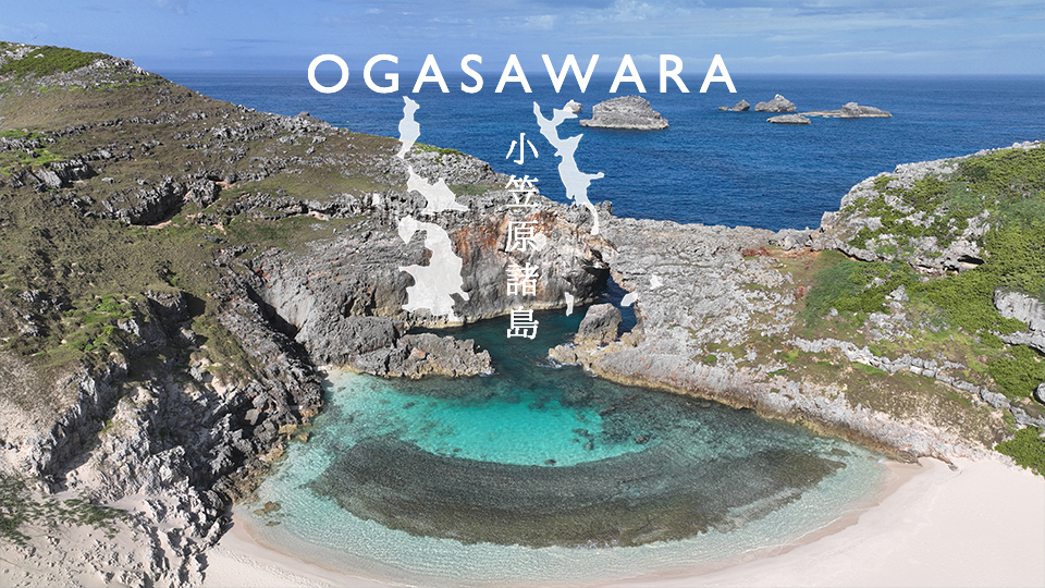
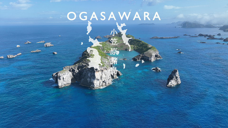
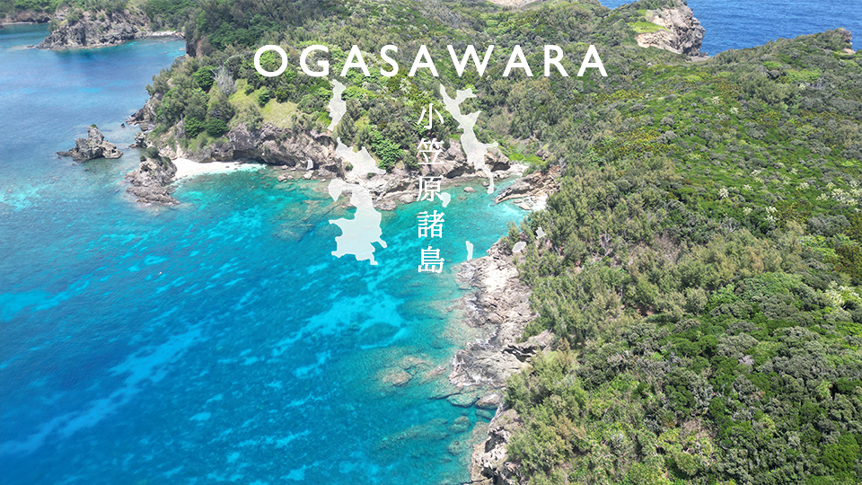
Tokyo, Ogasawara Islands, Hahajima "Horai-ne Coast" drone aerial photography

A beautiful sandy beach on an isolated island in the Pacific Ocean All permits were obtained for filming. Horai-ne Beach is a small sandy beach on the isolated island of Hahajima. The waterside is the perfect environment for children to play in the water. There is a beautiful coral reef near the beach, making it a snorkeling spot where you can encounter colorful fish in a fantastic atmosphere. There are also many other attractions in the area…

Tokyo: Ogasawara Islands, Hahajima "Little Fuji" drone aerial photography

The earliest first sunrise in Japan, "Ko-Fuji" Among the many local Fujis in Japan, the Ko-Fuji of Hahajima is probably the most remote. It is the southernmost local Fuji in Japan, located at 26 degrees north latitude and 142 degrees east longitude. It is also a place where people visit every year to see the earliest first sunrise in Japan. Many people, including locals, visit the local Fuji of Ogasawara, "Ko-Fuji".

Tokyo Ogasawara Village Chichijima "Minamijima Ogiike" drone aerial photography

The beauty of nature's formation will take your breath away. A picture-perfect tropical landscape! All permission was obtained for the photography. A turquoise blue natural pool and a white sand beach. Ogiike Pond on Minamijima Island is often featured in tourist brochures for Ogasawara. It goes without saying that it is beautiful, but it is also geologically and biologically…

Drone aerial photography of Chichijima "Minamijima" in Ogasawara Village, Tokyo

Only 100 people are allowed on this island per day! All permits are obtained for filming. Minamijima is an uninhabited island located southwest of Chichijima in the Ogasawara Islands, Ogasawara Village, Tokyo, measuring 1.5km from north to south and 400m from east to west. It is a rare island in the world with submerged karst topography. On the island, there is Ogiike Pond, a doline (depression) that is an inlet of seawater, where swimming and snorkeling are also possible.

Aerial photography of "Mikazuki no Odo" in Shimoda City, Shizuoka Prefecture using a drone

Legends of Minamoto no Yoritomo: Sankatsu no Oto: A sea cave in Tago, Shimoda, Shizuoka Prefecture. The cave was created when the weak part of the earth was eroded by the force of the waves. You can see the huge cave in Sankatsu to the east from Cape Tarai. You can see Togoku Island, where the legends of Minamoto no Yoritomo remain. Access: 〒415-0029 Shimoda, Shizuoka Prefecture…

Drone aerial photography of "Ryugu Sea Cave" in Shimoda City, Shizuoka Prefecture

Heart Spot!! What is Ryugu Sea Cave? When waves crash against the coast, weak parts of the cliff (soft layers of rock, faults, etc.) are eroded away, and sometimes caves are created. Sea caves that are created in this way are called sea caves. Ryugu Sea Cave in Toji was created when part of the ceiling of a larger sea cave collapsed, creating a cave with a diameter of 40 cm.

Drone aerial photography of "Minokakeiwa" in Minamiizu, Shizuoka Prefecture

Several agglomerates eroded by the waves This is a spot where the "tombolo phenomenon" occurs, which allows you to cross to Minokake Rock at low tide. Another spot where the tombolo phenomenon occurs is "Ogahama Beach," next to Yumigahama Beach. "Several agglomerates eroded by the waves stand upright on the sea like swords. Long ago, En no Ozunu, a man with magical powers, came to this spot..."

Drone aerial photography of "Dogashima" in Nishiizu, Shizuoka Prefecture

The charm of Dogashima! A spot where you can see the best sunset in Japan Dogashima is known as a scenic spot even among the Izu Peninsula. Standing here, you can understand how great and unique the artist called nature is. Dogashima, which is lined with a variety of strange rocks and scenic spots, is full of spectacular spots such as Tenmado Cave, Sanshiro Island, and Tombolo. If you look out to sea, you will see a strange shape…

Drone aerial photography of "Hirizo Beach" in Minamiizu, Shizuoka Prefecture

This coast, which lies on the border between the national parks of Irozaki and Nakagi, boasts exceptional transparency. Due to its unique geographical environment, which can only be reached by boat, nature has been preserved in its natural state. It is located at the tip of the peninsula, covered by steep cliffs, the surrounding area is a national park and has not been developed, there are no rivers nearby, and it is located in the most beautiful part of the Izu Peninsula.

Drone aerial photography of "Senkanmon" in Matsuzaki Town, Shizuoka Prefecture

Worth seeing - worth a thousand kanmon (1,000 kanmon) The wide area of the southern Izu Peninsula, including Nishiizu and Minamiizu, was created by undersea volcanoes and volcanic islands that erupted before Izu collided with Honshu. Senganmon, located at the end of the promenade, and Eboshiyama, visible to the right of Senganmon, are the remains of a "magma passage" that was once underground in an undersea volcano...